
Hikes in the
Parque Natural do Sudoeste Alentejano e Costa Vicentina
The Nature Park Sudoeste Alentejano e Costa Vicentina, designated in 1988, is around 75000 hectares big and is located in the southwest of Portugal. It extends along the Atlantic coast, the Costa Vicentina, over a length of 80 km between Porto Covo in Alentejo Litoral and Burgau, west of Lagos in the Algarve, and continues in the Alentejo to Sines.
In the park there are several types of landscapes with natural and semi-natural habitats such as rocky areas with steep and rugged cuts, beaches, numerous small islands and reefs, the mouth of the River Mira, the Cape Sardão, dunes, marshes, swamps, salt marshes, some lagoons, gorges (valleys with dense vegetation). The highest peak with an altitutude of 324m is located in São Domingos (Odemira, hike PR2).
In the natural park "Southwest Alentejo and Vicentina Coast" 4 walks are signposted.
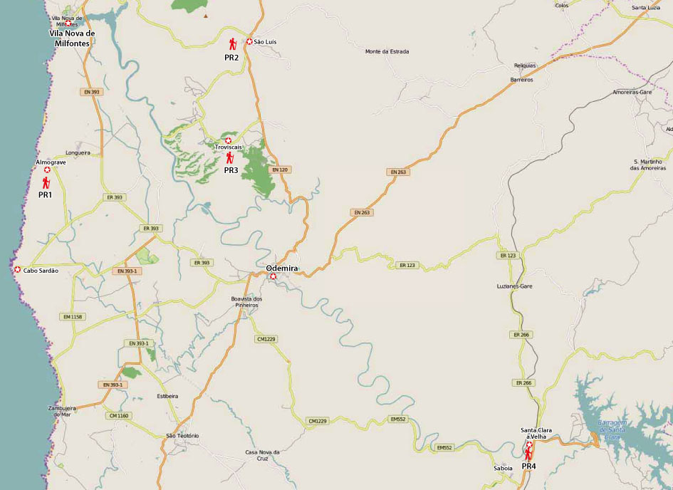
The map below gives the approximate location of these trails. More details and description to drive to the starting point on the individual map. Click on the Map for a printable version.
Costs Map: The maps are free to download. However, we ask for a Donation of 0,50 Euro (or any higher amount!). This allows us to keep our team happy who create and update these maps.
Map Download: Free Maps PR1 - PR4
You can donate simply with paypal:
Day Hikes Odemira
| NUMMER WIP | Name | Länge | Zeit | Link |
|---|---|---|---|---|
| Odm-PR1 | Lapa das Pombas | 8.9 km | 3h 30m | Detail |
| Odm-PR2 | Hortas de S. Luís | 3.5 km | 1.5h | Detail |
| Odm-PR3 | Troviscais ao Mira | 11.5 km | 3.5h | Detail |
| Odm-PR4 | Santa Clara | 10 + 13 km | 3+ 4h | Detail |