Hike Odm_PR3: Odm_PR4: Santa Clara Routes
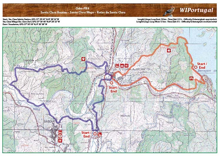
Start1: Sta. Clara Train Station, GPS: N 37° 29' 45"; W 8° 28' 54";
Start2: Sta. Clara Village, GPS: N 37° 30' 46"; W 8° 28' 32";
Start3: Dam, GPS: N 37° 30' 56"; W 8° 26' 38"
Länge: Ostwanderung 10km, Westwanderung 13km
Dauer:Ostwanderung 3,5 h, Westwanderung 4h
Wanderung PR4 im Parque Natural do Sudoeste Aletejano e Costa Vicentina
Length: East Loop 10km, West Loop 13 km
Time:East Loop 3.5 h, West Loop 4 h
Hike PR4 in the Parque Natural do Sudoeste Aletejano e Costa Vicentina
Costs Map: The map are free to download. However, we ask for a Donation of 0,50 Euro (or any higher amount!). This allows us to keep our team happy who create and update these maps.
You can donate simply with paypal: