Home|Accomodation Service|Online Shop| Contact| zur Deutschen Sprache

Via Algarviana Long-Distance Trail

Via Algarviana Long-Distance Trail


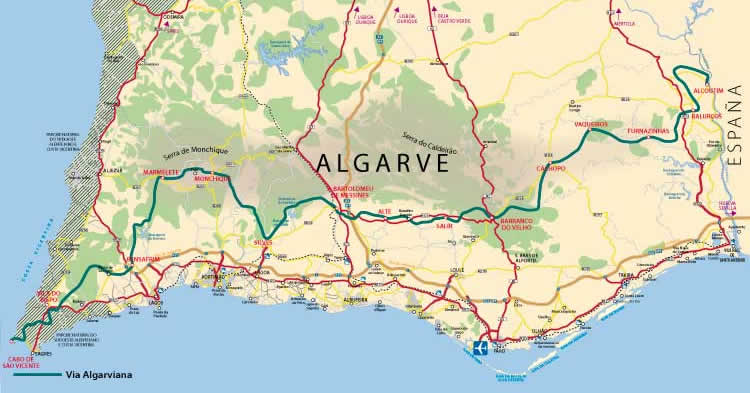
The Long-Distance Trail covers in 14 Sections the Hike from the spanish Border to Cap São Vicente. The Via Algarviana Team also added additional 6 Connection Trails in November 2013 to connect the coast to the Via Algarviana.


Detailled Maps of all these trails are available at the following website:

viaalgarviana.org

Sectors Via Algarviana
Number WIP Name Length
(km)
Time Difficulty Track
VIAALG-1 Alcoutim - Balurcos 24 7 h moderate Track Google Earth
VIAALG-2 Balurcos - Furnazinhas 14,3 4 h easy Track Google Earth
VIAALG-3 Furnazinhas - Vaqueiros 20,3 6 h moderate Track Google Earth
VIAALG-4 Vaqueiros - Cachopo 14,9 4 h moderate Track Google Earth
VIAALG-5 Cachopo - Barranco do Velho 29,1 8 h difficult Track Google Earth
VIAALG-6 Barranco do Velho - Salir 14,9 5 h easy Track Google Earth
VIAALG-7 Salir - Alte 16,2 5 h easy Track Google Earth
VIAALG-8 Alte - Messines 19,3 5 h easy Track Google Earth
VIAALG-9 Messines - Silves 27,6 8 h moderate Track Google Earth
VIAALG-10 Silves - Monchique 28,2 8 h difficult Track Google Earth
VIAALG-11 Monchique - Marmelete 14,7 4 h moderate Track Google Earth
VIAALG-12 Marmelete - Bensafrim 30 7 h moderate Track Google Earth
VIAALG-13 Bensafrim - Vila do Bispo 30,1 8 h moderate Track Google Earth
VIAALG-14 Vila do Bispo - Sagres 16,6 5 h easy Track Google Earth
Etappen Connection Trails
Nummer WIP Name Length
(km)
Time Difficulty Track
VIAALGLigSBras Sao Bras - Parizes 18 5 h moderate Track
VIAALGLigLoule Loule - Salir 28 7 h schwer Track
VIAALGLigLagos Lagos - Bensafrim 10 3 h easy Track
VIAALGLigAlje Aljezur - Marmelete 19 5 h moderate Track
VIAALG GR13.6 Ameixial - Barranco do Velho 25 7 h schwer Track
VIAALG GR13.7 Albufeira - Alte 29 8 h schwer  


It is also possible to do the Via Algarviana by Mountain Bike. For more information: www.toursandtracksalgarve.com/products/via-algarviana