
Day Hikes in the Parque Natural de Montesinho
Throughout the Park one senses an intense rural atmosphere, expressed in the villages where the traditional slate or granite houses merge with the landscape itself. Sometimes one can hardly sense the presence of these houses, given the almost perfect harmony between man and nature.
The Park’s landscape is characterised by gentle rolling hills and rounded rocky outcrops, complemented by valleys where rivers flow between poplars, alders, willows and large woodlands of black oak, chestnut trees and holm-oaks.
The different settings denote variations in soil characteristics and climate -- lush and green in the western part, still influenced by maritime breezes, and more rugged and open to continental influences in the eastern section. The mountain ranges of Coroa (1273 m) and Montesinho (1486 m) constitute the highest points in the Park, and benefit from a light, invigorating breeze above all during the summer.
The geological diversity of this space includes a predominance of slate and areas of chalk in the mountain plateaus and granite in the higher zones of the Serra de Montesinho. These factors, together with climatic variations, originate a highly varied plant life, and an ideal habitat for animals such as the wolf, wild boar, roe deer and around 240 other animal species.
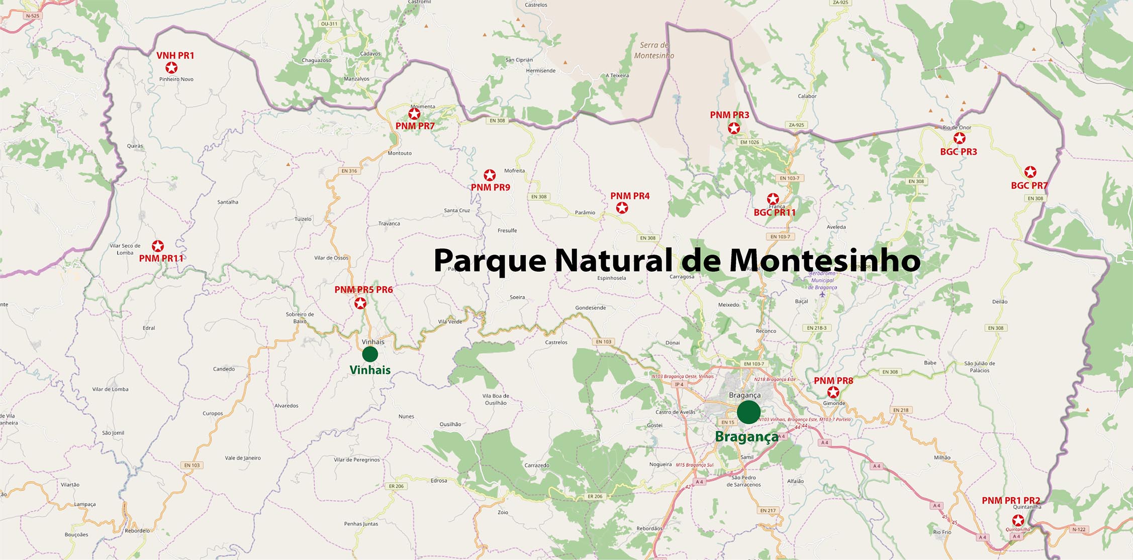
The Park Administration created various hiking trails (abbreviated PNM). Additionally there are hiking trails of the Bragança District (BGC).
Overview (for high-resolution please click on the map)
Costs Map and Track: The maps are free to download. However, we ask for a Donation of 0,50 Euro (or any higher amount!). This allows us to keep our team happy who create and update these maps.
You can donate simply with paypal:
Dayhikes Parque National de Montesinho
| NUMBER WIP | Name | Length | Time | Link |
|---|---|---|---|---|
| PNM PR1, PR2 | Rio Maçãs | 11/3 km | 3h / 2h | Detail |
| PNM PR3 | Porto Furado | 7.7 km | 3h | Detail |
| PNM PR4 | Ornal | 7.9 km | 3h | Detail |
| PNM PR5, PR6 | Ribeira de Ladrões | 11.4 km 5.6 km |
4h 2h |
Detail |
| PNM PR7 | Calçada | 7.7 km | 3h | Detail |
| PNM PR8 | Malara | 12 km | 4h | Detail |
| PNM PR9 | Termas do Tuela | 8,1 km | 3h | Detail |
| PNM PR11 | Tresmonte | 9 km | 3h | Detail |
| BGC PR3 | Rio de Onor | 11 km | 3h | Detail |
| BGC PR7 | Guadramil | 8.5 km | 2.5h | Detail |
| BGC PR11 | Montesinho | 10 km | 2.5h | Detail |
| VNH PR1 | Fragas do Pinheiro | 11 km | 3h | Detail |