
Hikes in the
Parque Natural das Serras de Aire e Candeeiros
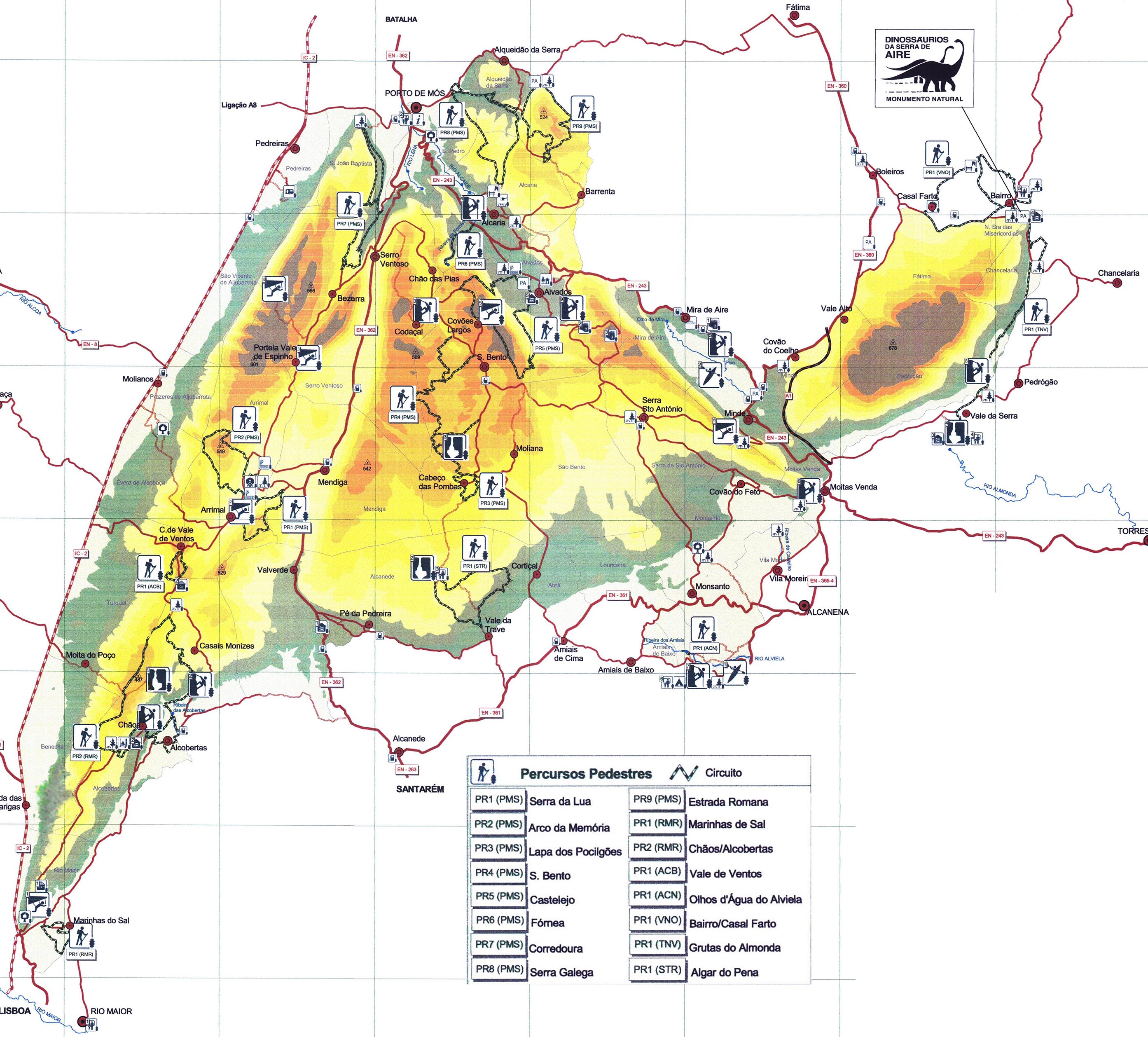
Overview (for high-resolution please click on the map).
The Park Administration provided a booklet about the various hikes in the park. This booklet can be downloaded below (size 8 MB):
Guide to Walking Tours in the Aire and Candeeiros Mountain Ranges National Park
Costs Map and Track: The maps are free to download. However, we ask for a Donation of 0,50 Euro (or any higher amount!). This allows us to keep our team happy who create and update these maps.
You can donate simply with paypal:
| NUMBER_WIP | Name | Designation |
Area | Length (km) | Time | Link |
|---|---|---|---|---|---|---|
| {NUMMER_WIP} | {Name} | {Bezeichnung} | {Gebiet} | {Wege::Länge} | {Zeit} | {Link} |
Day Hikes P.N. Serras de Aire e Candeeiros
No Map available, only Track
| NUMBER WIP | Name | Length | Time |
|---|---|---|---|
| ACB PR1 | Vale de Ventos | 2.5 km | 1.5h |
| ACN PR1 | Olhos d' Água do Alviela | 2 km | 1h |
| RMR-PR1 | Marinhas de Sal | 3 km | 1.5h |
| RMR-PR2 | Chaos Alcobertas | 16 km | 7 h |
| STR PR1 | Algar do Pena | 9 km | 3 h |
| VNO PR1 | Bairro/Casal Farto | 10 km | 5 h |