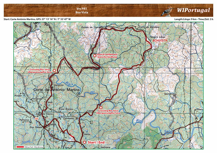
Hike Vila Real S. António PR1- Boa Vista
Start: Corte António Martins, GPS: 37° 13' 16.08" N / 7° 33' 47.22" W - Google Map
Length: 9 km
Duration: 3 h
Approach: From the motor way A22 Exit Monte Gorde. Continue on to the N125 direction Altura/Tavira. In Vila Nova de Cacela turn on the EM509 towarts Corte António Martins.
Map: Free Map (pdf format).
Costs Map: The maps are free to download. However, we ask for a Donation of 0,50 Euro (or any higher amount!). This allows us to keep our team happy who create and update these maps.
You can donate simply with paypal: