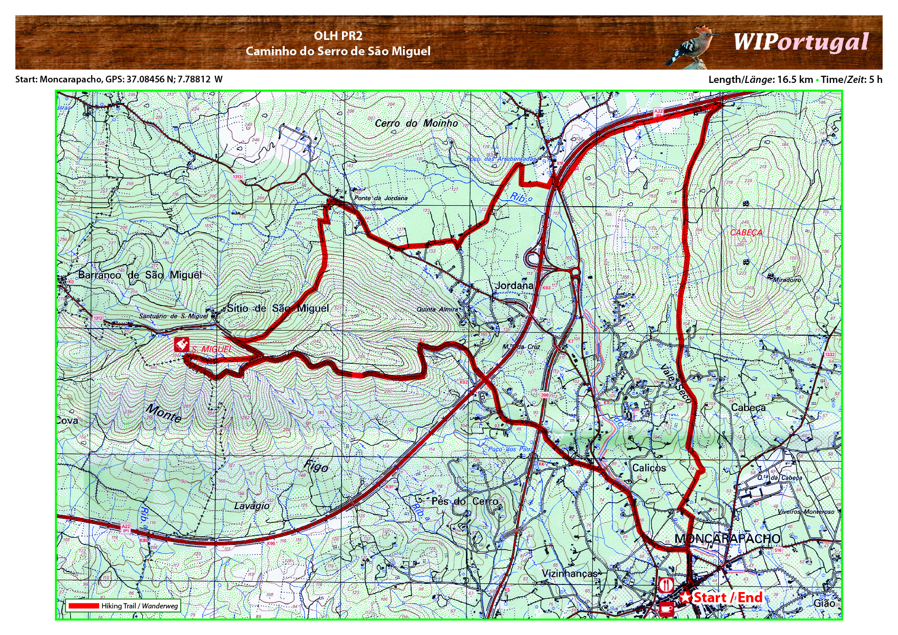
Hike OLH PR2 - Cerro de São Miguel
Start: Moncarapacho GPS: 37.08456 N / 7.78812 W
Length: 16.5 km
Duration: 5h
Approach: From the motor way A22 Exit Olhão. Immediately after the exit at the round-about, follow the signs to Moncarapacho. Start of the hike near the church.
Map: Free Map (pdf format).
Costs Map: The maps are free to download. However, we ask for a Donation of 0,50 Euro (or any higher amount!). This allows us to keep our team happy who create and update these maps.
You can donate simply with paypal: