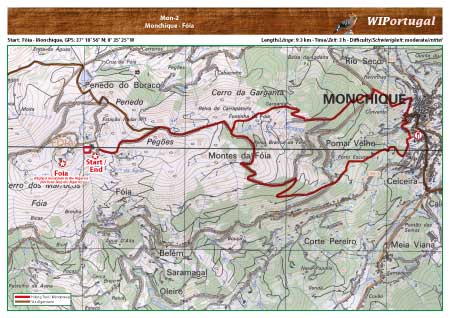
Hike Monchique 2: Monchique - Foia
Hike in the hilly area of Monchique. From the highest Algarve Mountain, Foia, to Monchique and back.
No markings along the route.
Start: Fóia, GPS: 37° 18' 56" N / 8° 35' 25" W- Google Map
Length: 9,3 km
Duration: 3 h
Access: From the A22 exit Monchique and drive to Monchique. In the village, follow the signs to Fóia. Hike starts at the parking area on top of the mountain.
Tracks: Track as GPX file available. The Track comes together with the Map.
Map: Free Map (pdf format) and Track Download.
Costs Map and Track: The maps are free to download. However, we ask for a Donation of 0,50 Euro (or any higher amount!). This allows us to keep our team happy who create and update these maps.
You can donate simply with paypal: