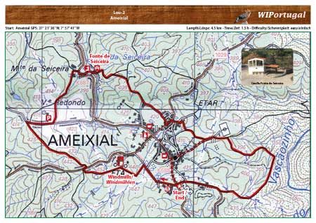
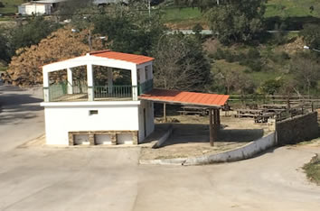
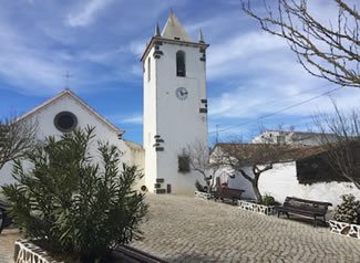
Hike Loule PR1 - Ameixial
Hike around the village of Ameixial.
Start: Ameixial GPS: 37° 21' 36,43" N / 7° 57' 40.89" W - Google Map
Length: 4,5 km
Duration: 1h 30m
Access: From the motorway Exit Loulé. In Loulé follow the signs Ameixial/Barranco do Velho. In Barranco do Velho turn left towards Ameixial. Start of the hike at the entrance of the village.
Tracks: Track as GPX file available. The Track comes together with the Map.
Map: Free Map (pdf format) and Track Download.
Costs Map and Track: The maps are free to download. However, we ask for a Donation of 0,50 Euro (or any higher amount!). This allows us to keep our team happy who create and update these maps.
You can donate simply with paypal: