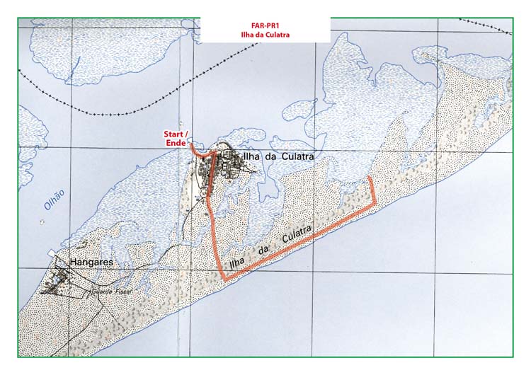
Hike Faro PR1 - Island Ilha da Culatra
Hike at Ilha da Culatra along the beach.
Start: Ferry Olhão to Ilha da Culatra. Ferry-Terminal in Olhão: GPS: 37º 1' 25" N / 7º 50' 15" W - Google Map
Length: 5,6 km
Duration: 2h
Access: From the motorway A22 Exit Olhão. In Olhão, the ferry-terminal is near the Market-Halls.
Map: Free Map (pdf format) Download.
Costs Map and Track: The maps are free to download. However, we ask for a Donation of 0,50 Euro (or any higher amount!). This allows us to keep our team happy who create and update these maps.
You can donate simply with paypal: