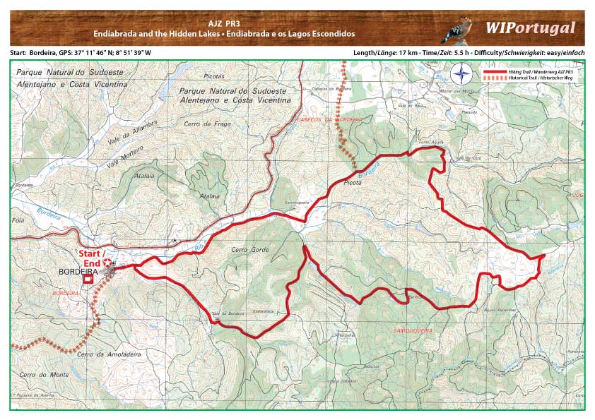
Hiking Trail Aljezur AJZ PR3 - Endiabrada
The Hike goes through a forrest in the Natural Park Sudoeste Alentejano e Costa Vicentina.
Way marked.
Start: Bordeira
GPS: 37º 11' 46" N / 8º 51' 39" W
Length: 17 km
Duration: 5 h 30 min
Map: Free Map (pdf format) Download.
Costs Map and Track: The maps are free to download. However, we ask for a Donation of 0,50 Euro (or any higher amount!). This allows us to keep our team happy who create and update these maps.
You can donate simply with paypal: