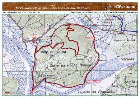
Hiking Trail Silves 5 - Along the Levadas on
Ilha do Rosário
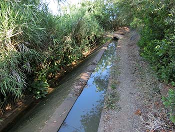
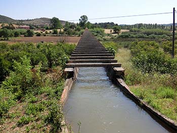
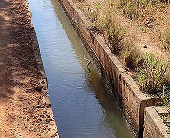
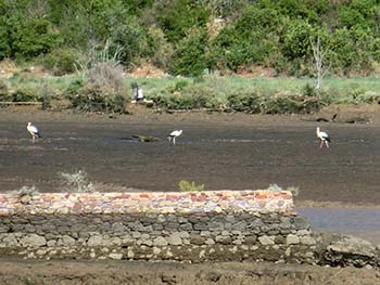
A Hike along the Levada of Silves, with many plants, animals and birds to see. Good Views over the River Oldelouca. In the distance the Mountains of Monchique, Foia and Picota in the North and Portimão in the Southwest.
No markings on the trail.
Update of the Map: June 2015
Start:Falacho/Silves, GPS: 37° 11' 11" N / 8° 29' 12" W - Google Map
Length: 7.4 km; Time: 2.5 h
Access: From the Motorway A22 Exit Silves. In Silves drive over the Bridge. After the Bridge turn left until the starting point.
Tracks: Track as GPX file available. The Track comes together with the Map.
Map: Free Map (pdf format) and Track Download.
Costs Map and Track: The maps are free to download. However, we ask for a Donation of 0,50 Euro (or any higher amount!). This allows us to keep our team happy who create and update these maps.
You can donate simply with paypal: