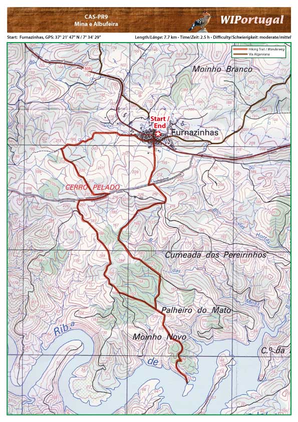
Hike Castro Marim PR9 - Mina e Albufeira
Hike between Furnazinhas and the reservoir.
Start: Furnazinhas Centre, GPS: 37º 21' 47" N / 7º 34' 29" W - Google Map
Length: 8 km
Duration: 2.5h
Approach: On the road IC 27 towards Mertola. Exit on the road 505 to Furnazinhas..
Tracks: Track as GPX file available. The Track downloads together with the Map.
Map: Free Map (pdf format) and Track Download.
Costs Map and Track: The maps are free to download. However, we ask for a Donation of 0,50 Euro (or any higher amount!). This allows us to keep our team happy who create and update these maps.
You can donate simply with paypal: