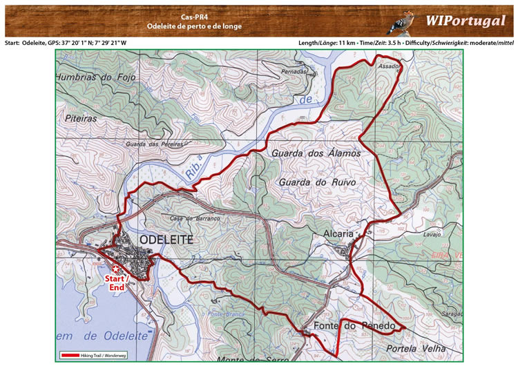
Hike Castro Marim PR4 - Odeleite de perto e de longe
Start:Odeleite GPS: 37° 20' 1.52"N / 7° 29' 19.76"W- Google Map
Length: 11 km
Duration: 3.5 h
Note: Do not walk on hot days
Approach: From the motor way A22 Exit Castro Marim. Turn north onto the IC 27 and exit at Odeleite.
Start of the hike at the parking area of the cemetry.
Tracks: Track as GPX file available. The Track comes together with the Map.
Map: Free Map (pdf format) and Track Download.
Costs Map and Track: The maps are free to download. However, we ask for a Donation of 0,50 Euro (or any higher amount!). This allows us to keep our team happy who create and update these maps.
You can donate simply with paypal: