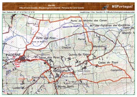
Hike Albufeira PR3- Hike of Cerro Grande
First a hike in the valley of the river Algibre. Then coninue the hike along the hills of Cerro Grande.
Markings along the trail.
Start: Paderne, GPS: 37º 10' 33" N / 8º 12' 15" W - Google Map
Length: 12 km
Duration: 3h
Approach: From the Motorway A22 Exit Albufeira. Follow the Signs towards Ferreiras and then towarts Paderne. Parking area at the beginning of the village, just after the cemetry.
Tracks: Track as GPX file available. The Track comes together with the Map.
Map: Free Map (pdf format) and Track Download.
Costs Map and Track: The maps are free to download. However, we ask for a Donation of 0,50 Euro (or any higher amount!). This allows us to keep our team happy who create and update these maps.
You can donate simply with paypal: