
Day Hikes in the Alto-Alentejo
In the Alto Alentejo an Network of Day Hikes was developed by "CIMAA", a cooperation between the various villages of the region. The list below consists of all hikes of the network, including hiking maps and digital tracks for free download.
All the leaflets and maps are in the english language!
(Exept the Gavião hikes: at the moment only in portugueses language)
All the hikes have a Number. This number indicates the district of the hike. The following abbreviations are used:
Alter do Chão (ALT); Arronches (ARR); Campo Maior (CMR); Castelo de Vide (CVD); Elvas (ELV); Gavião (GAV); Marvão (MRV); Monforte (MFT); Nisa (NIS); Ponte de Sor (PSR); Portalegre (PTG)
A flyer in the english language is available with information about the landscape and the culture.
Download of the Flyer ( Size: 68MB)
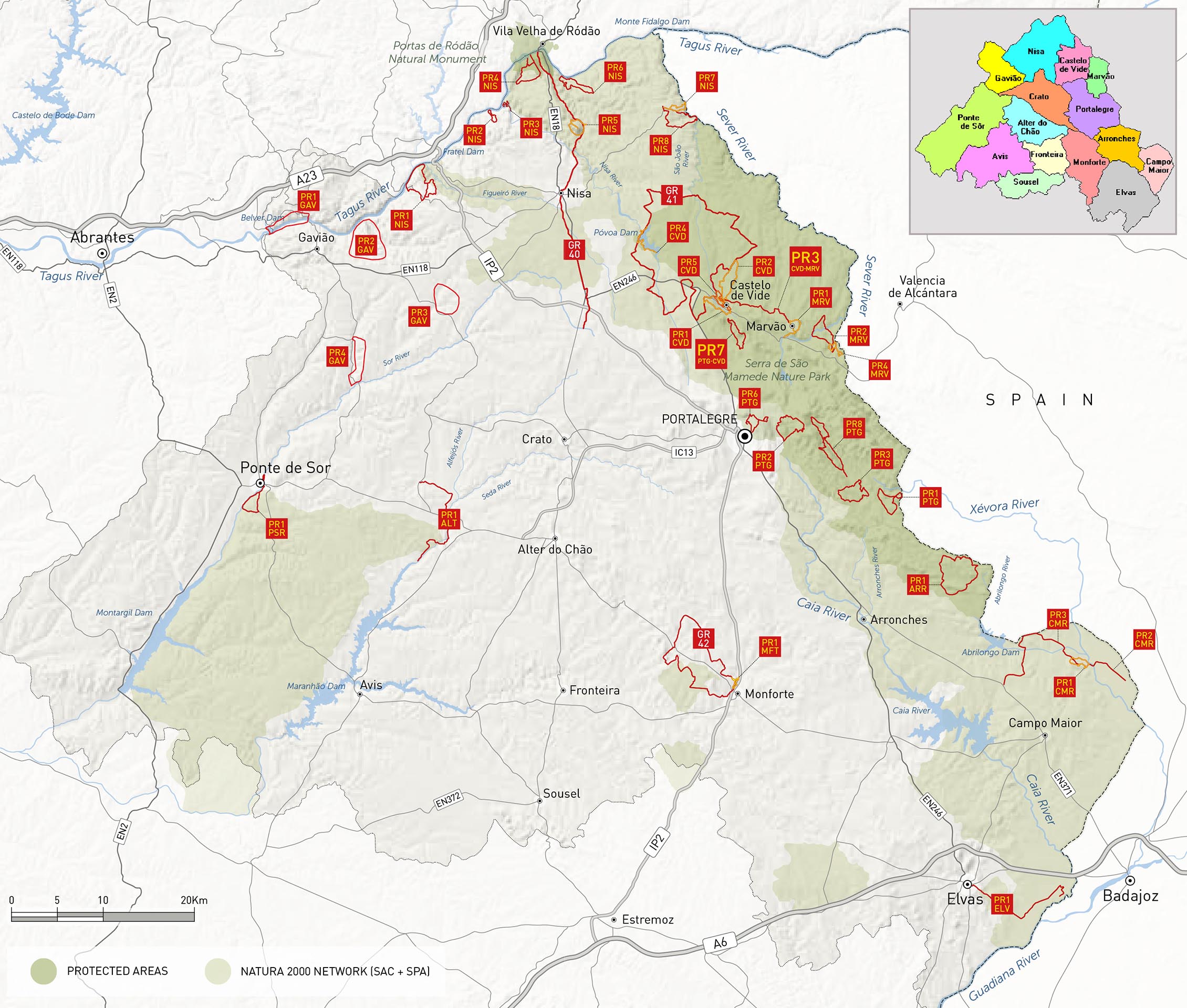
Overview (for high-resolution please click on the map)
Costs Map and Track: The maps are free to download. However, we ask for a Donation of 0,50 Euro (or any higher amount!). This allows us to keep our team happy who create and update these maps.
You can donate simply with paypal:
| NUMBER_WIP | Name | Designation |
Area | Length (km) | Time | Link |
|---|---|---|---|---|---|---|
| {NUMBER_WIP} | {Name} | {Designation} | {Area} | {Wege::Length} | {Time} | {Link} |