
Hiking Trails in the Algarve
The various citys and villages in the Algarve have signed various hiking trails. But often the markings are missing or very difficult to see. Without the right Hiking-Map, the probability to get lost is quite high.
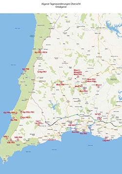
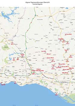
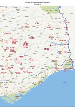
Because of this problem, we provide on this site Hiking Maps for all the Day Hikes in the Algarve.
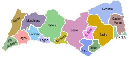
All Hikes in the Algarve have a WIP Number. This number indicates the area of the hike. The following appreviations are used:
Albufeira (ABF) / Alcoutim (ACT) / Aljezur (AJZ) / Castro Marim (CTM) / Faro (FAR) / Lagoa (LGA) / Lagos (LGS) / Loulé (LLE) / Monchique (MCQ) / Olhão (OLH) / Portimão (PTM) / São Brás de Alportel (SBA) / Silves (SLV) / Tavira (TVR) / Vila do Bispo (VBP) / Vila Real de St. António (VRS)
| NUMBER_WIP | Name | Designation |
Area | Length (km) | Time | Link |
|---|---|---|---|---|---|---|
| {NUMMER_WIP} | {Name} | {Bezeichnung} | {Gebiet} | {Wege::Länge} | {Zeit} | {Link} |