
Hikes in the District Castelo Branco
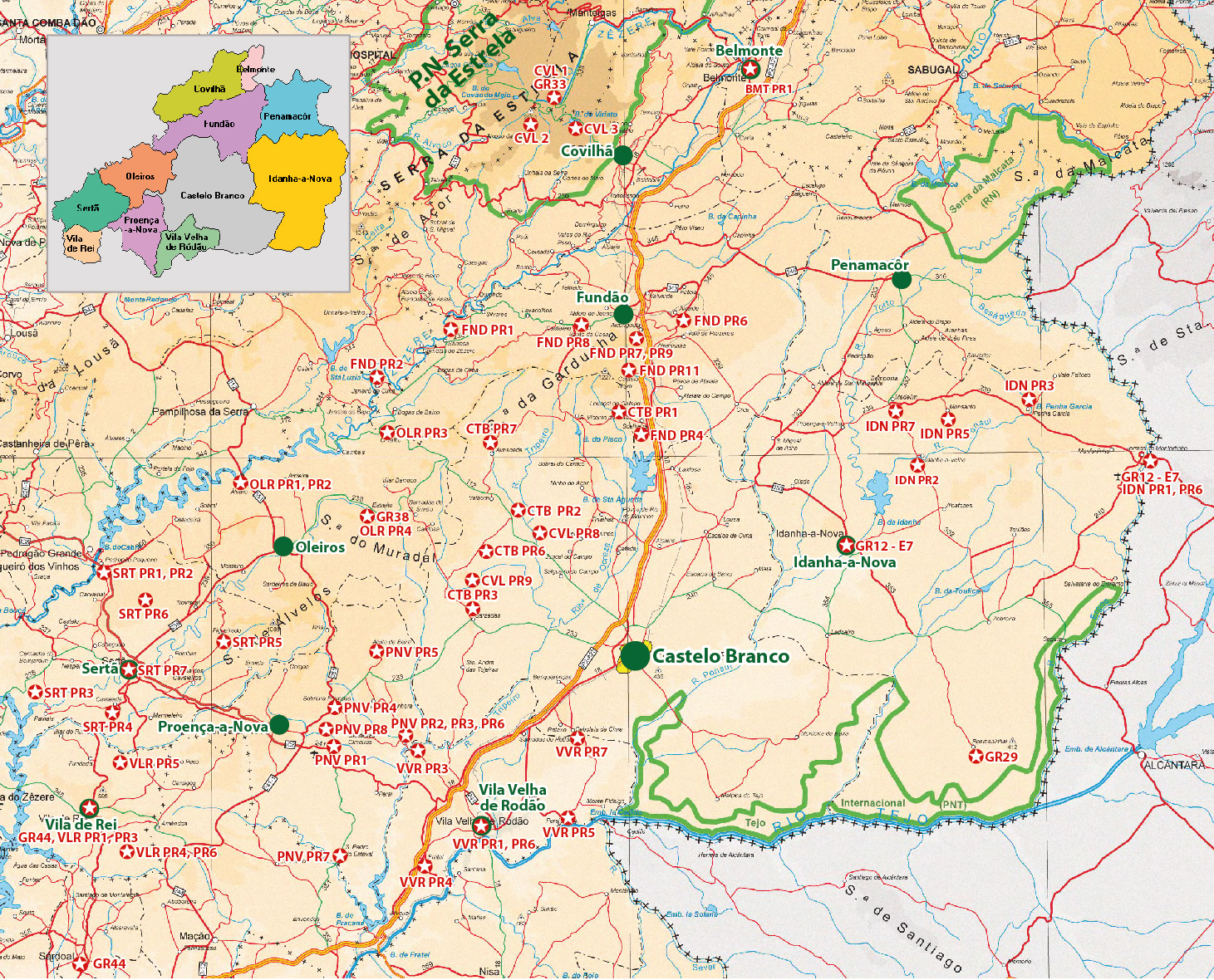
The District Castelo Branco is located in the East of Portugal. The mountain range Serra da Estrela in the North-West of the District has the highest mountains inside Continental Portugal.
Overview (for high-resolution please click on the map).
The used appreviations are:
Castelo Branco (CTB), Covilhã (CVL), Fundão (FND), Idanha-a-Nova (IDN), Oleiros (OLR), Proença (PNV), Serta (SRT), Vila de Rei (VLR), Vila Velhao de Rodão (VVR)
Costs Map and Track: The maps are free to download. However, we ask for a Donation of 0,50 Euro (or any higher amount!). This allows us to keep our team happy who create and update these maps.
You can donate simply with paypal:
| NUMBER_WIP | Name | Designation |
Geb | Length (km) | Time | Link |
|---|---|---|---|---|---|---|
| {NUMMER_WIP} | {Name} | {Bezeichnung} | {Gebiet} | {Wege::Länge} | {Zeit} | {Link} |